Design activity is based on technical and scientific know-how which allows to offer the most modern solutions on the market, in according to law’s limits, financial budget and opex saving.
Scientific and technical know-how believes from a first-level academic training of the team, improved with many years of experience, allowed to develop simulation models for process in wastewater treatment plants with output on mechanical, electromechanical, dimensional and microbiological characteristics of physical-chemical and biological purification plants.
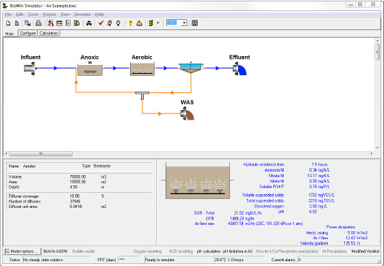
The Biowin software
In addition to the stationary models, the dynamic simulation software “Biowin” is used as the main tool and enables a dynamic simulation of the wastewater treatment plant process, therefore not only it achieves average or “project” results from different parameters, but also their time-varying as a function of temporal patterns of flow and concentrations inflow; in that way, during the design phase, it’s already possible to simulate different system configurations and operatiopnal scenarios, also integrating the Key Performance Indicators (KPI), which provide information on the Residual Treatment Capacity for each plant section.
The BIOWIN software
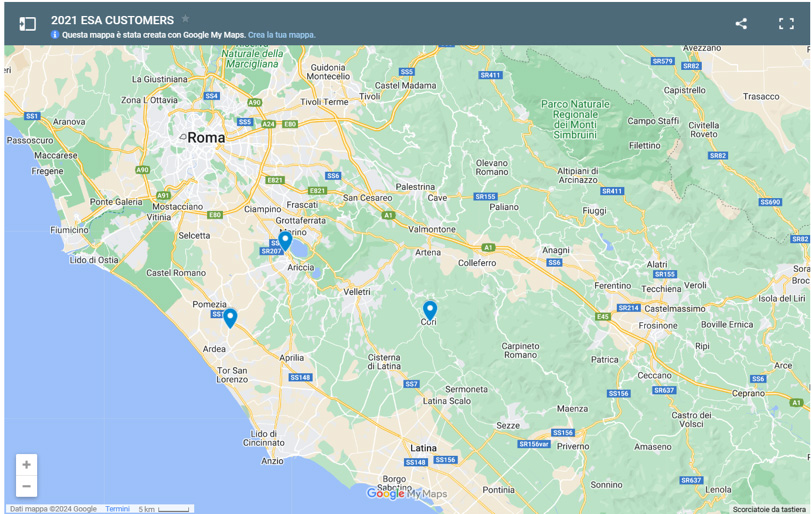
Localizzazione Licenza Biowin Envirosim
Sewerage and hydrology
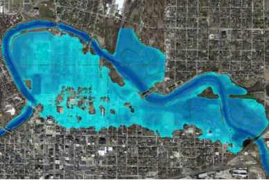
As well as for wastewater treatment plant, the focus is on the Hydrology and sewerage systems, conducting hydrological and hydraulic studies necessary to verify the water conditions in watercourses, or implementating mathematic models for management, optimisation of existing sewerage or the design of new sewerage infrastructures.
The main tool used for hydrological studies is “HEC-RAS” software, developed by the US Army Corps of Engineers, which allows the user to perform one-dimensional steady flow, one and two-dimensional unsteady flow calculations, sediment transport, mobile bed computations, and water temperature or water quality modeling.
The hydrological study is based on LIDAR Composite DTM (Digital Terrain Model), that is a raster elevation model at 1m spatial resolution, properly processed then by GIS software.